The trip home is usually one filled with stressful thoughts of work, responsibilities of the real world and longing for the places you just left. This drive home was different because although we felt those things, we knew we had one last day of adventure!
We popped into the Mojave to have lunch. We didn’t want to set foot in a gas station or restaurant and loose our connection with dirt.


Something about seeing a bush make these lines in the sand from days or weeks of wind is oddly comforting. It reminds you that whether you go visit nature or not, it’s doing it’s thing. It doesn’t need any help and it’s not waiting for you.

We hit the super slab and high tailed it back into AZ. Although we’d had a great trip and would miss our friends we were longing to be remote. It’s a strange thing to say after “overlanding” in Death Valley, I know. For us, seeing 20 or 30 other trucks passing us as we explore makes us feel like we’re in a busy place. We needed a night to decompress in a truly remote spot.
We exited the highway in the nothing town of Yucca, AZ, home to the Chrysler Proving Grounds. (What the hell do they prove there anyway? Not much from the looks of a PT Cruiser)
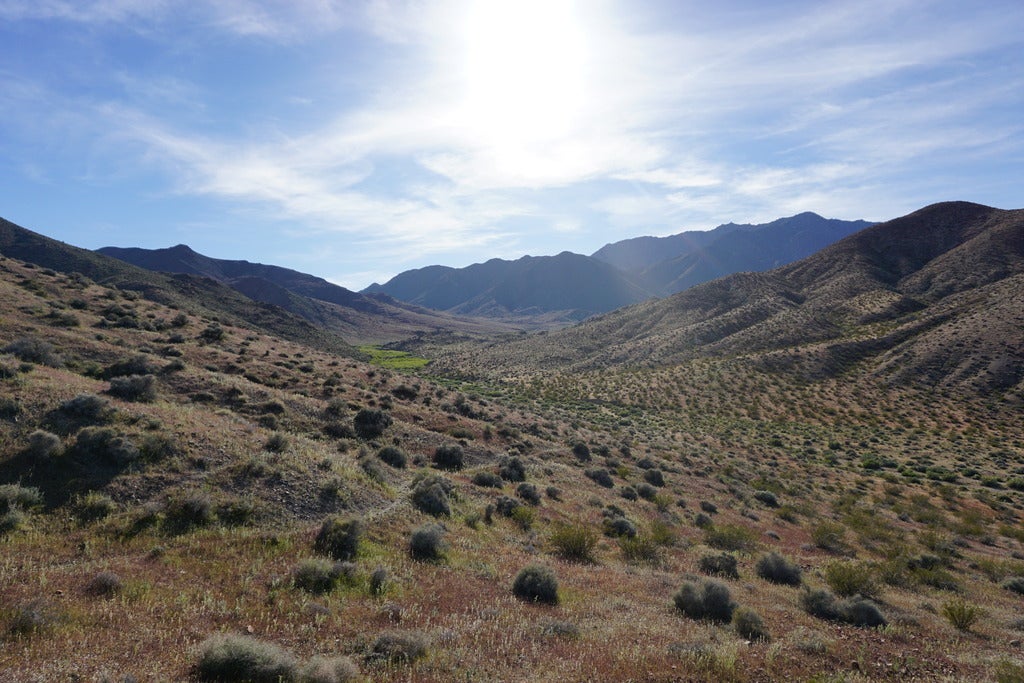
It goes from boring desert near the highway to beautiful and lush desert just a few miles towards the Hualapai mountains.

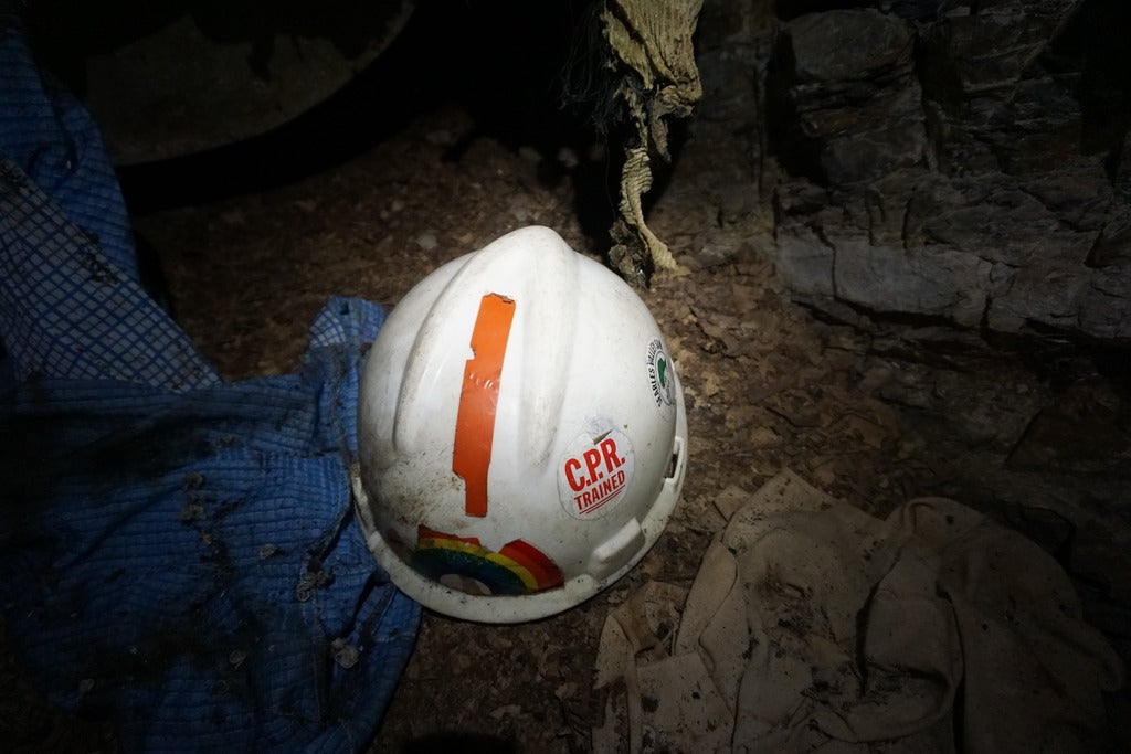
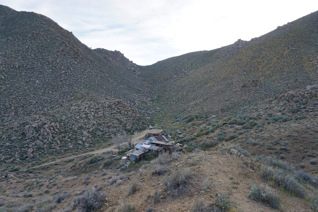
There is a lot of mining history in these hills.

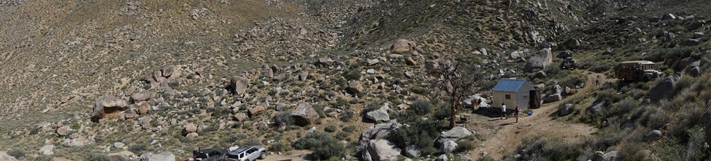
After driving along feverishly trying to find a side trail we found a promising one. Fairly good size brush meant no one had visited for months. Off of that road we found an even lesser used road. Something clicked at that moment. This was enough. This finally, was complete and lonesome solitude. I had found it, at least for a night.

There were some ranching remains of a feed tank and even an old corral with a fire pit. Certainly not a place NO MAN had ever been, but one that had been forgotten. Perfect.

Time to cook some Carne Asada! I’d been carrying it the entire trip, but the group meals were so large we’d never used it.


It was a great night of relaxing... well, we were so tired we actually passed out by 9PM... Adventuring takes it out of you.
The next morning I wanted to use our final day to take some seldom used roads that aren’t on most maps. See, the thing is, I’d mapped these mountains about 7 years ago so I had a faint memory of what roads went where. Since I didn’t do the entire mountains by myself there were areas I didn’t know of course.
Step 1, check out this road we camped on to see where it went.
A mine. A copper one to be exact.

To you or I this might look like a BIG mine, but after hours of searching the best we could find was a couple mentions of it in mining records of the late 1800s into the 1940s. It seems to have been worked even into the 60s. It was just too small of an effort to report on whereas there are several other mines just a few miles away that have entire books written about them.

The explosives shed looked stout!

I’m not sure what it is, but it’s oddly beautiful and ornate.

These locks have seen better days.

Behind those not so secure locks is the lower shaft.

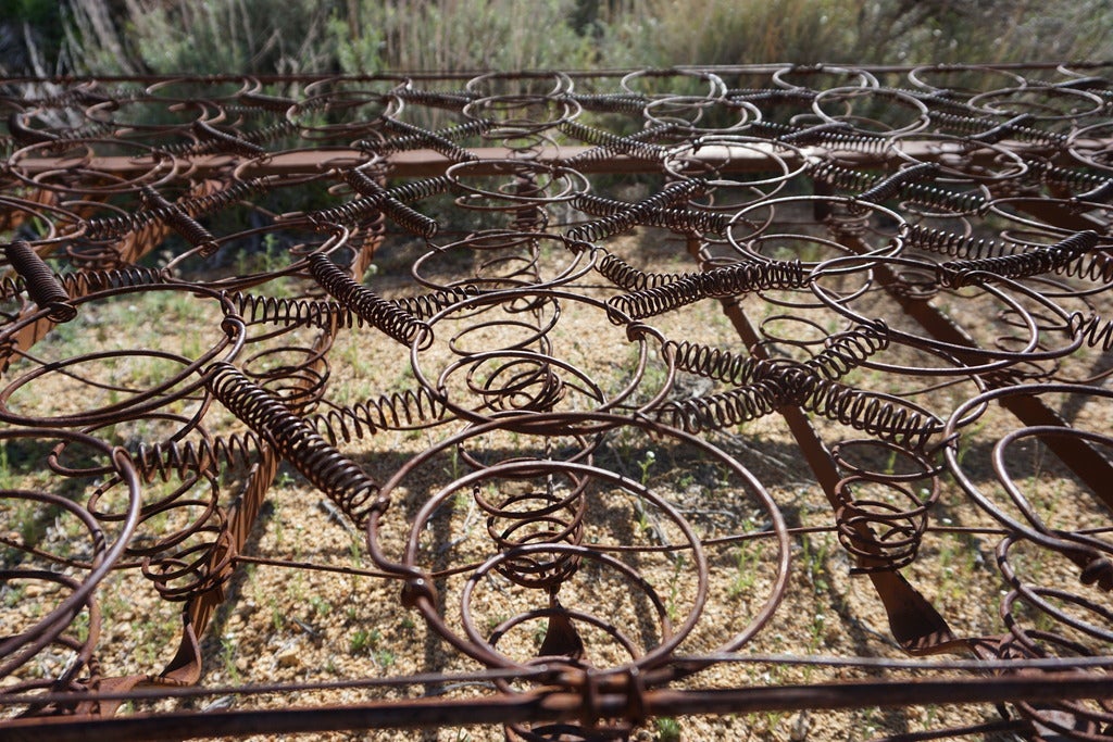
A bit of a trucks leaf springs and rear end.

These ore cart tracks travel over to the top of the ore shoot. This would have been impressive to see work back in it’s prime. Men moving all over like ants to extract as much of the green gold as they can.


I’ve seen boards like this before in mines. I think it’s a chart to keep a record of either “loads of ore” or “Which miners are underground” at any given time.

There was a small slot in this wall. A timecard slot? Outgoing mail? Not sure, but it’s interesting to see that even in remote mining operations you still have the basic rules and bureaucracy of an office.

Water, all mines operate on water. Finding a steady source for use or conversely pumping out the mine so it doesn’t flood. It’s either an asset or a huge challenge. These pipes were strung all over the mountain.

I don’t bet any of the men working hard up here had much time to pause and remark on how beautiful this area of Arizona is, but we sure did.

These rich looking rocks of copper ore were all over the tailing pile. You could feel the substantially greater weight of these VS the normal rocks nearby.


Time to hit the road and start making our way towards the small town of Wikieup!
This site is more heavily written about for the discovery of a new mineral named after the mine’s name. Antlerite! This is Antler Mine.


The head frame was impressive as was the mine shaft sinking down a couple thousand feet. Yikes. I got chills just taking this shot.

The ground is littered with core samples.

The tailings are so immense it gives you a good visual of just how deep the main shaft must go.

Back on the road we went. Now in low range. Plodding our way towards the mountains that would get us home.

I’m always glad to wake up a rattlesnake while in my truck. It’s while standing next to them I have far less appreciation.


Ascending we went. I recognized our trail. It’d been a long time, but if you read my mapping the southwest posts you might recognize some of the area ahead. The difference being we weren’t in snow and on motorcycles. “Hmm, now that road was wide enough for a big ol landcruiser, right...? right..... maybe”

It’s not often you feel a connection with a plastic sign, but when you’re the one who installed it, you do. :-)

At first the trail was a decent size. The tracks were UTV or “Golf Cart” sized, but the trail was wide enough for Goose.

The higher we climbed the tighter it got. My tires road along the bushes next to the visible tracks. It wasn’t a positive sign and I took note of it.

Somewhere around here, I stopped worrying about photos. This is where the trip goes fairly dark in a visual sense.

For the next hour we had to work as a team. There were a few boulders that my mind remembered seeing only as we rounded the bend. AHA, shoot... I remember that rock from long ago. Why didn’t I remember that one.. Hmm.
“Okay babe, I need you here fully and completely. We’ll be fine, but it will take some time and working together. Okay?”
“I’m terrified, but I will do whatever you need.”
“Okay, I am going to have to go on the inside of this one. Stand on the passenger side away from the truck and let me know how many inches I have until we hit.”
There were 3 where we had to go up and close to the inside of the cliff and 5 where we had to go to the outside of a boulder to get around them. On the inside hill ones the truck was leaning at about a 45 degree slant to the boulder and then the cliff. I was really only focused on the boulder.
“Okay, you just slid a bit on that last move. You only have an inch before it hits the door of the truck.”
“Shit, okay I’m going to try something.”
“okay, that worked. You have 6 inches. Pull forward and I’ll put a rock under your tires as you go to see if we can make the truck lean a bit less.”
“Shit, okay I’m going to try something.”
“okay, that worked. You have 6 inches. Pull forward and I’ll put a rock under your tires as you go to see if we can make the truck lean a bit less.”
Literally inch by inch we made progress. My left foot on the brake and right on the gas trying to make progress as steady and controlled as I could. On the boulders we had to take on the outside I could see the side of the truck well so I knew when I had inches to spare. What I couldn’t see is the cliff side.
Everything in my mind said, “you are beyond the limit of what you can guesstimate. As far as we are concerned your tires are already off the cliff.”
With this lack of guesstimation and getting it right being all the more important I relied COMPLETELY and unequivocally on Kelsey.
With this lack of guesstimation and getting it right being all the more important I relied COMPLETELY and unequivocally on Kelsey.
“I am going to put the truck as close to the boulder as we possibly can. I need you to constantly and without pause call out how close we are to the edge. If anything get’s squirrely just yell stop and I will stop all movement. Okay?”
The “okay” I got sounded an awful lot like “I’ll do my best, but I’m not so sure about this.”
Well, here we go!
“You’re good, you have 6 inches, good, good, good, getting close, maybe 3 inches, moving away from it now, you’ll go up on a rock for a second, okay, coming back down, you’re clear.”
On one I actually hear, “you are touching the rock.” It was like the blood drained from my face.
“Is it bad?” I said in my most defeated tone.
“No, I don’t think it even left a dent yet. You are literally just touching it so slightly.”
On another one I heard “The boulder is touching the fender flare, but it’s giving and it doesn’t seem to be leaving a big scratch.”
Oh good. I found myself saying “Sorry Goose” out loud.
Once we were through the worst of it we saw a sight that lifted our spirits. 2 wild horses running along the trail. They weren’t just lost as they were unshod and very scared of humans. These were true wild horses.

That was a wonderful sight. It somehow made it all worth it.I don’t want to do it again, but it was worth it to do it once.
Near the top we had one last boulder that we now considered easy compared to the rest. “Hell, let’s get at least one photo of what we’ve been doing for the last couple hours!”
Quick team work and we were through.

Phew, we made it to the top. Damnit, I wish we had a drone follow us up that.

At the summit that was covered in snow last time I was here.

At the top we caught one last sight of the wild horses before they took off. We later research the nearest known area that Game and Fish try to keep the wild horses in. It was more than 100 miles away. These two apparently have their own mountain to enjoy.

Well, we made it to the top of a questionable road. We still have to make it down just as many miles now. I could tell you that the way down was wonderful and easy, but that would be a lie.
I can say that it wasn’t as scary. Unfortunately, for our buddy Goose it was a lot more brutal. Camera away, mirrors pulled in, we proceeded to pinstripe the truck like I’ve never pinstriped any before. The bushes were too close together for even a UTV or small jeep. That meant that every bit of Goose from the hood to the rear quarter panel was being scraped. Bits of rubber seals were ripped off, trim pieces were popped loose.
I found myself repeating “I’m sorry Goose. I’m so sorry. Sorry buddy” Over and over again like rainman.
When we finally got through it to a road with signs of use measured in days instead of years we stopped for a long lunch and a cold one. What a day. I was sad for Goose, but he’d made it. I was sorry to put K through all of that, but she did great and I knew we’d be fine. This is what Goose is made for. I try to avoid this level of abuse, but we’d had a great adventure and it brought the three of us closer together. So, time to wax Goose a couple of times and order some replacement parts for the hurt trim.
Then on to ordering up next months maintenance pieces for Goose to keep him in top form, and so on. Gotta stay ahead of the curve.
Just before hitting pavement nature made one last effort to keep us from going back to real life. I really wanted to give in.

Thanks for reading along. Until next time.
www.hu-bar.com